

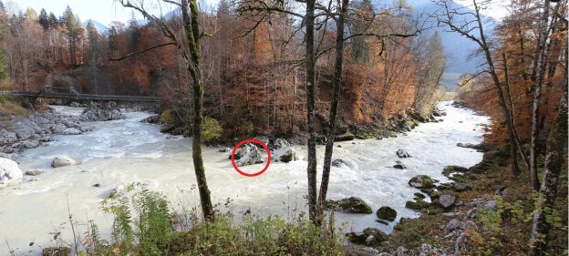
Canoe cam Saalach
At the Teufelssteg in Lofer
Here you get some current impressions of the conditions and the weather at the Teufelssteg with a view of the Saalach.
Water Level indicator
Alongside the water level measurements in Weißbach and Unterjettenberg and the canoe-cam, the water level indicator is an additional source of information for all white water athletes.
The water level indicator has been fixed to a rock in the middle of the picture. You have to zoom in a little on the picture on the cam.
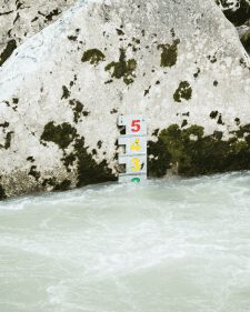
Scale:
The green range (1-2) indicates a lower to medium risk. The values in the yellow range (3-4) indicate a higher risk. If the water level is in the red range (5) or the water level indicator can not be seen at all, this means there is a very high risk.
More information with corresponding details about the two adjacent river sections WM Slalom Course (Hubertussteg – Teufelssteg) and Teufelsschlucht (Teufelssteg – Au):